

Willamette Valley Travel Alerts
We hope you have a safe, enjoyable, and fun time on your next visit to the Willamette Valley. In the event of wildfire or other inclement weather events, here are some trip-planning tools, alerts, and helpful resources to stay updated and prepared.
Current Wildfire News and Updates
As of July 24, 2026, there are currently no wildfires impacting the Willamette Valley—but visitors traveling to and from Central Oregon are advised to avoid Highway 20 around Sisters due to the Akawa Butte Fire at this time.
Visit TripCheck.com for the latest traffic alerts, and view the State of Oregon Fires and Hotspots Dashboard for the most up-to-date information about where fires may be burning and how big they might be.
Know Before You Go
Prepare for a safe, enjoyable visit with a few quick and easy tips:
- Campfire restrictions: Pitching your tent or parking an RV? Check in with your campground's land manager (such as the Willamette National Forest or Oregon State Parks) to see whether there are currently any restrictions on campfires. Learn more about campfire safety.
- Firewood: If campfires are permitted at your campground of choice, be sure to pick up firewood within 10 miles of your weekend getaway to help prevent the spread of pests.
- Air quality: Browse the Oregon Air Quality website to check air quality and wildfire smoke levels in your desired destination.
- TripCheck: Visit the Oregon Department of Transportation's TripCheck tool for live road conditions, traffic webcams, alerts, closures, and other helpful trip-planning tools.
- Water safety: If you're paddling one of our many lakes or boating the Willamette River, check out the Oregon Marine Board's Water Safety website for the skinny on life jackets, boat launches, local regulations, and other helpful resources.
- Leave no trace: Leave your outdoor destination better than you found it by brushing up on—and abiding by—the Leave No Trace principles.


Road Closures & Alerts
Though the likelihood is typically low, it's always possible that lane and road closures may impact your travels. Prepare for occasional delays throughout the Cascade Range and around the Willamette Valley on your next road trip with this look at what to expect on the road.
Pro tip: It can't hurt to visit TripCheck.com for up-to-the-minute travel alerts, maps, webcams, closure information, and other advisories.
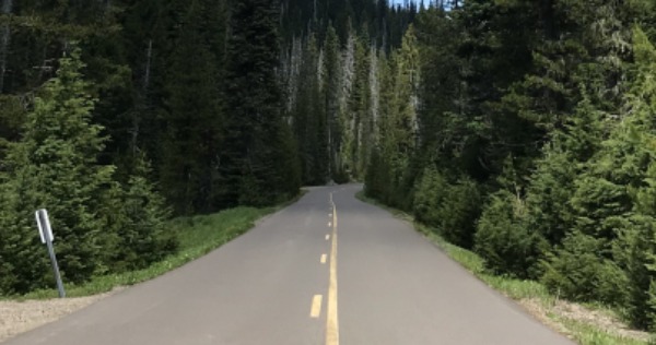
Highway 20 (Sisters)
July 24, 2026: Visitors traveling to and from Central Oregon via Highway 20 around Sisters are advised to find a different route due to the Akawa Butte Fire at this time. Visit TripCheck.com for the latest traffic alerts and potential closure information.
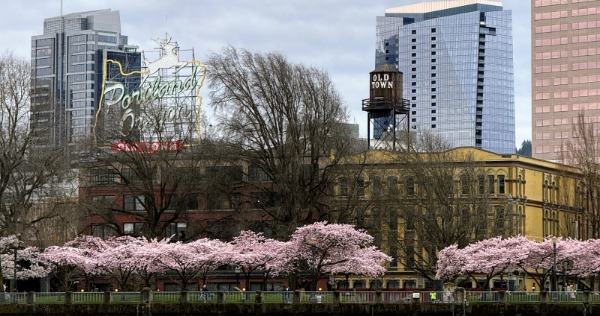
Interstate 5 (Portland)
September-October 2026: If you're passing through Portland on your way to the Willamette Valley in late summer or early fall, be advised that Interstate 5 southbound (between I-405 and I-84) will be closed for up to five weeks starting on September 11, 2026.
As part of the work, crews will make repairs and repave the surface. Drivers will be re-routed onto I-405, which heads through downtown Portland, and can consider taking I-205 on the city's east side to bypass the closure entirely. Learn more about the I-5 Rose Quarter Improvement Project.

Highway 22
Ongoing: Expect short, occasional delays along Highway 22 around Detroit Lake as crews continue to clean debris from 2020 wildfires and work to ensure safety of drivers and residents. Many businesses were damaged or destroyed in the fires; with limited services in the Santiam Canyon area, be sure to fill your gas tank, and pack plenty of water, food, and other supplies.

Oregon Route 224
Ongoing: Oregon Route 224 around Estacada has reopened following the Riverside Fire, which began around Labor Day 2020. Prepare for infrequent, temporary road closures and delays as crews remove debris, repair asphalt, and work to clean up the wildfire-scarred area. Visit Oregon's Mt. Hood Territory for the latest traffic alerts along OR-224.
Outdoor Recreation Closures
Some outdoor recreation areas remain closed in the wake of various wildfires. Here's a quick rundown of what might be impacted:

County Parks
Several county parks throughout the Willamette Valley remain closed due to various wildfires; visit Marion County Parks, Linn County Parks, and Lane County Parks for the latest on county-park closures.

McKenzie River
Vast stretches of forest burned along the McKenzie River in the Holiday Farm Fire; Travel Lane County has put together a Google Map showing recreation sites along the river (and along OR-126)—and whether they’re open or closed at this time.
Community Support and Assistance
Even though the region's wildfires have been contained, it's a long road to recovery for displaced residents, small-business owners, and others impacted by the natural disaster. Here are a few ways to help those in need.
Santiam Canyon Fire
- The Mid-Valley Wildfire Relief Fund (from United Way of the Mid-Willamette Valley) offers support for those impacted in the Santiam Canyon area.
- Breitenbush Hot Springs suffered devastating losses in the Beachie Creek and Lionshead fires— numerous buildings were completely destroyed—and is accepting donations to help rebuild.
Broad Relief Efforts
- Cascade Volunteers is the nonprofit partner of the Willamette National Forest; the group coordinates volunteers and directly invests in the forest's recreational facilities— including the Santiam and McKenzie districts, both battered by wildfires. Funds are going toward post-fire restoration efforts.
- The Red Cross Cascades Region is getting emergency financial assistance into the hands of residents whose homes were burned or lost in the wildfires— and is still accepting donations.
- The Wildland Firefighter Foundation is accepting donations to support wildland firefighters and their families.
(Unless otherwise noted, all wildfire photos courtesy of Oregon Department of Transportation / Flickr)